Hurricane Erin To Unleash Dangerous Surf And Rip Currents Along U.S. East Coast, Bermuda
on Aug 18, 2025
Hurricane Erin To Create Dangerous Conditions Along The Coast
Hurricane Erin has strengthened again to a Category 4 storm Monday (August 18), churning offshore and creating dangerous coastal conditions for much of the U.S. East Coast, Bermuda, and parts of the Bahamas and Atlantic Canada.
The storm’s size is now the main concern, after outer rain bands swept across Puerto Rico over the weekend, causing flash flooding and power outages, and began affecting the southeast Bahamas and the Turks and Caicos.
“Even though Erin is expected to remain far offshore, the threat to life from rip currents and high surf along our beaches is very real,” the National Weather Service said.
Hurricane #Erin Advisory 29A: Erin Likely to Become Even Larger Over the Coming Days. https://t.co/tW4KeGdBFb
— National Hurricane Center (@NHC_Atlantic) August 18, 2025
North Carolina’s Outer Banks is a region that is potentially expected to get hit hard.
Evacuations were ordered on several barrier islands along the Carolina coast as officials warned that the storm could generate dangerous rip currents and inundate roads with waves reaching up to 15 feet.
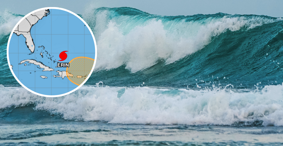
By Monday afternoon, the storm was positioned approximately 140 miles north of Grand Turk Island and 850 miles southeast of Cape Hatteras.
Tropical Storm Erin Forcast To Become Hurricane
Last week, the tropical storm continued to intensify in the Atlantic and was forecasted to become a hurricane over the weekend.
As of 11 a.m. Thursday (August 14), Erin was positioned about 890 miles east of the Northern Leeward Islands, tracking west-northwest with maximum sustained winds of 60 mph. Its central pressure had dropped to 999 millibars, a sign of the storm’s growing strength and improved organization since the early morning advisory.
Erin originated from a tropical wave near Cape Verde and became the first major hurricane of the 2025 Atlantic season. It reached Category 5 strength with sustained winds around 160 mph and an extremely low central pressure near 915 mb, one of the fastest intensification rates recorded in the Atlantic.
The official 2025 Atlantic hurricane season began on June 1, and will run through November 30.
According to the NHC, the peak of the season typically falls between mid-August and late September, with September 10 statistically noted as the most active day of the season.
Tropical systems are classified based on sustained wind speed, ranging from tropical depressions to Category 5 hurricanes. Once a storm reaches 39 mph, it becomes a named tropical storm and at 74 mph, it is classified as a hurricane.